California's Best Camping
For complete information about all the best camping in the area, including Donner Lake and around Lake Tahoe, visit our sister website, California's Best Camping
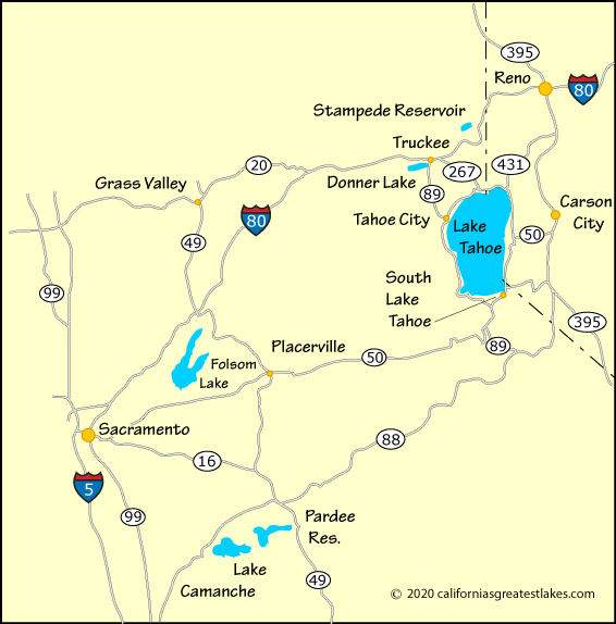
The best approach to South Lake Tahoe is via Highway 50, either coming from Sacramento or Carson City, NV. If coming from the Truckee area, the best route is south to Tahoe City and down the west side of the lake to South Lake Tahoe. It's a slow drive, however.
An alternate route to South Lake Tahoe is to use Highway 88 either from California or Nevada and then at Hope Valley cross over to South Lake Tahoe on Highway 89.
For complete information about all the best camping in the area, including Donner Lake and around Lake Tahoe, visit our sister website, California's Best Camping
| Miles | Hours | Mins. | |
|---|---|---|---|
| Bakersfield | 373 | 6 | 11 |
| Fresno, CA | 271 | 4 | 39 |
| Las Vegas, NV | 477 | 8 | 31 |
| Los Angeles | 482 | 7 | 51 |
| Placerville | 58 | 1 | 16 |
| Reno, NV | 64 | 1 | 48 |
| Redding | 262 | 4 | 27 |
| Sacramento | 101 | 1 | 59 |
| San Francisco | 186 | 3 | 22 |
| San Jose | 215 | 3 | 49 |
| Stockton | 147 | 2 | 40 |
| Tahoe City | 28 | 1 | 08 |
| Truckee | 42 | 1 | 32 |