California's Best Camping
For complete information about all the best camping in the area, including Trinity Lake, Whiskeytown Lake, and all up and down California, visit our sister website.
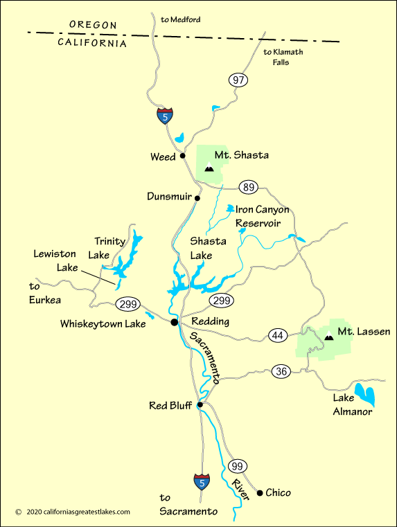
For most people on the West Coast, driving to Shasta Lake is a simple matter of getting onto Interstate 5 and following it either north or south until you arrive at the lake.
From the Eureka area, Highway 299 leads across the coastal mountains to Redding.
From the Reno go north on Highway 395 to Susanville, then go west on Highway 36 to Red Bluff before turning north on I-5.
For complete information about all the best camping in the area, including Trinity Lake, Whiskeytown Lake, and all up and down California, visit our sister website.
| Miles | Hours | Mins. | |
|---|---|---|---|
| Eureka | 164 | 3 | 20 |
| Chico | 90 | 1 | 40 |
| Los Angeles | 561 | 8 | 43 |
| Medford, OR | 131 | 2 | 10 |
| Oroville | 111 | 1 | 54 |
| Portland, OR | 401 | 6 | 37 |
| Red Bluff | 49 | 49 | |
| Redding | 17 | 17 | |
| Reno, NV | 240 | 3 | 36 |
| Sacramento | 179 | 2 | 50 |
| San Francisco | 235 | 3 | 45 |